skip to main |
skip to sidebar
Up and out fairly early (7:30 am). Made a blasphemous stop at the Wal-Mart Super Center for toiletries and some fruit to make up for last night's gluttonous fried gator dinner. Then to the Coffee Cabana (complete with an aquarium of fish and a beach scene wall mural) for a bagel and tea. To be honest, I had not expected to find a coffee shop in Sedalia, MO.
Heard a news report on the radio about a car crashing into a motel in Chillicothe, one of the towns I passed through in Ohio. A collision in front of the Green River Inn Motel led to one of the cars going through the lobby and down the hall far enough to end up in the men's restroom. No one was injured, including the driver. Now that would have been something to see.
Passed the town of Knob Noster. I don't even know what to say about that one.
This is not specifically trip-related, but I feel compelled to mention it: I stopped at McDonald's outside of Kansas City to inspect the facilities (pee) and got one of their new fruit & walnut salads. Very tasty and relatively healthy, but in true McD's fashion, the packet of walnuts has an ingredient listing three lines long.
And, next to the McD's, I saw the first true sub-division of the trip, with the close-packed houses and lack of full grown trees that are so commonplace back home. The suburbs of Kansas City must be burgeoning.
Entered Missouri on highways yesterday and left it that way today, passing around and below Kansas City. One thing I forgot to mention about MO: The rural routes that bisected 50 are all designated alphabetically, rather than numerically. I kept imagining what it would be like to give directions: "Yeah, you go down B, take a right on ZZ, then hang an immediate left on J..."
50 so far in Kansas has been four lanes, almost flat and less interesting than previous states, but it's definitely got one thing going for it: a 70 mph speed limit.

The rolling flats of the four lane stretch of 50 put me into a coma, so I looked for food as the road went through Emporia, KS. Surprisingly, the stankiness of the Tyson meat plant right at the edge of town didn't put me off my appetite and I ended up at a truck stop right where 50 narrows back down to two lanes. After lunch, it'll be interesting to see whether going back to passing slower cars will wake me up again.
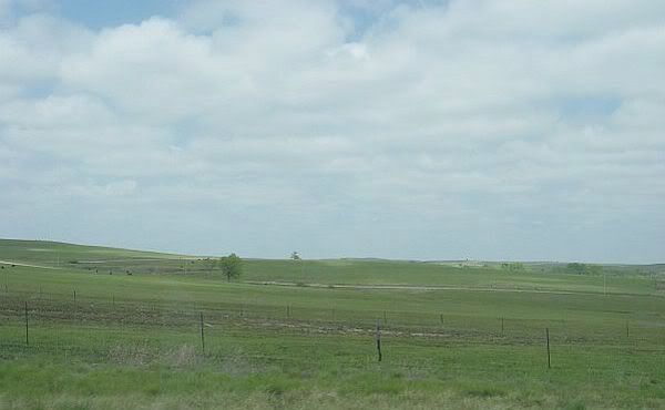
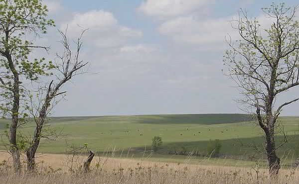
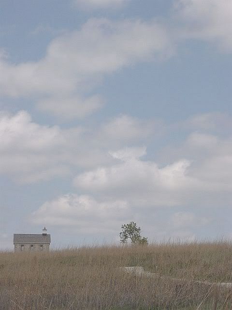
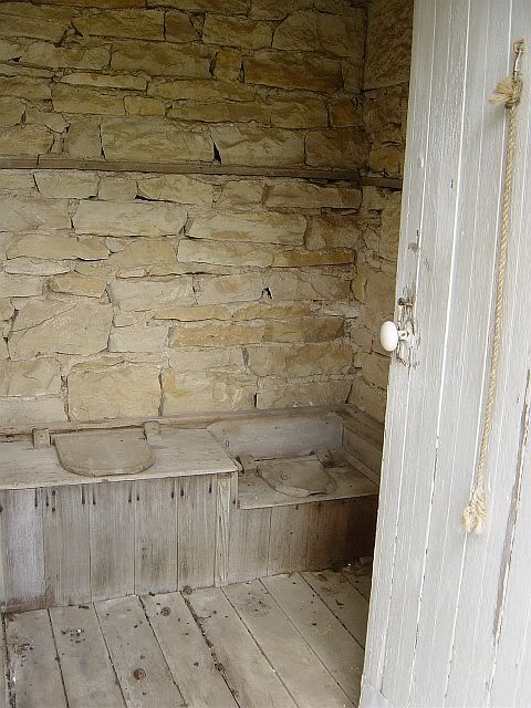
One of my planned stops was Tallgrass Prairie National Preserve. I'm not even sure how to describe it without sounding contrived or corny. The easiest way, probably, is to think of the scene in Dances With Wolves when Lt. Dunbar first sees the prairie grasslands and walks along in awed silence, with his hands held out to reverently brush the tops of the grasses. But on a smaller scale. I realized how cool it was going to be a few miles before I turned off 50, when I looked around and realized just how different the landscape suddenly was. I think I even spoke aloud to myself, saying something like "Ok, now we're really far from home!" ('we' being the Pony and me). I mentioned that to the rangers in the visitor center, saying that it felt like I had finally made it to the West, and they told me about a section in Least Heat-Moon's PrairyErth when he apparently drives by Tallgrass on 50 and says just about exactly the same thing. So, anyway, I hiked the short nature trail, torn between snapping photos of everything and just putting the camera away and experiencing it all. Great place. Hopefully, my photos do it justice. (Post-trip note: Unfortunately, they don't.)


(For a few more photos, click here)
West of Newton, KS, the land suddenly got flat. Did I say that IL & MO were flat? I must have been on crack. Through the 30 or so miles from Newton to Hutchinson, the only elevation in the landscape is the lines of trees that separate the fields.
Stopped in Hutchinson for the night. Interesting place. Large rural town (population 40k or so). I entered town on a stretch of road surrounded by huge, I mean huge, grain elevators. That gave way to "civilization"-- a mall, big-box stores, hotels and the second Starbuck's of the trip. Also, the first Target. Oh, and Wal-Mart count as of Hutchinson= 10, plus 2 distro centers.
After checking in to Comfort Inn, I drove down into the town proper. At first glance, Hutchinson seems like a typical, run-down, farming-oriented town, but... A slow cruise down the main strip revealed two coffee shops, a theater currently in auditions for "Murder on the Orient Express", a Renaissance garb/supply store, and a couple of cool looking antique shops. Oh, and a bingo parlor with a guaranteed $500 payout every night! Too bad that place was only open Monday, Thursday and Saturday. On the way back to the hotel, I found a neighborhood of totally charming Sears & Roebuck bungalow houses. I get the feeling that Hutchinson hides its light under a bushel basket (or a grain elevator, perhaps?).
The jacuzzi in last night's hotel room was nice, but what really impressed me was the shower with the massage head (for my sore shoulder) and the outward-curving shower bar. In the words of Lili Von Shtupp in Blazing Saddles: "I feel wefweshed!" Time to hit the road.
Passed from Seymour into Odin, IL, where a blackbird was sitting on the town sign doing his best impression of one of Odin's ravens. Then, on to Center City, "Home of Andy J. Kindle, Emmy-Award Winning Television Director". Center City flowed into Centralia, "Home of the Winningest Basketball Team in the World", where I lost 50 West and somehow ended up on 51 South. Stopped at a Huck's to get re-oriented. Gentleman behind the counter nodded toward the Pony and commented, "That's a nice little ticket-getter". I had to admit he was right.
Passed through Carlysle, where the sign proclaimed, "See Illinois' Largest Lake!" I didn't see any of the lake, but found it amusing that the sign was placed in front of a tiny little fish hatchery pond. Stopped in Lebanon for tea and spinach quiche at a little teahouse-type cafe. 50 in IL so far is a good cruising road-- mostly straight and flat, two lanes with a divided yellow line down the middle to allow passing.
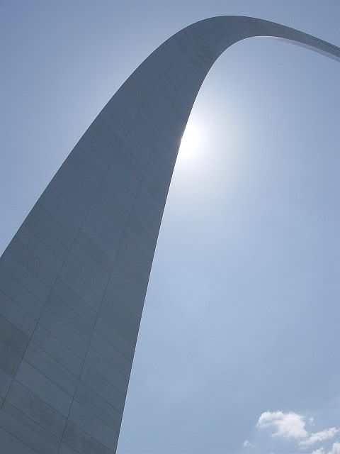
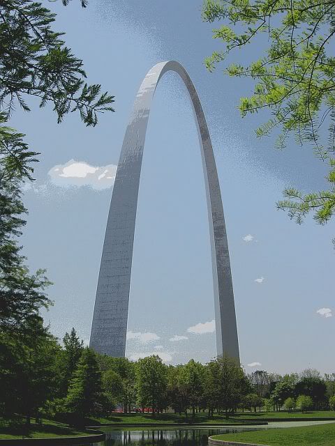
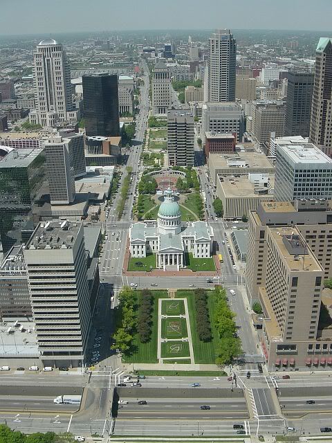
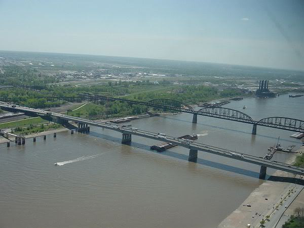
Of course, I had to stop and do the tourist thing at the Gateway Arch in St. Louis (or, properly, the Jefferson National Expansion Memorial). Quick factoid: The Arch is 630 feet tall at its highest point, and the same number of feet wide from one base to the other. Riding to the top was very interesting-- the teeny spaceship-escape-pod-looking trams you ride in seem to be the originals with a fresh coat of paint. I was also surprised that I didn't get motion sick on the way up or down. The view, of course, was pretty cool. According to a laconic ranger, you can see for 30 miles.


Wandered over to Lacledes Landing (the hip, touristy area that I have no idea how to pronounce) to find postcards and lunch.
I wish I could say something about the mighty Mississippi River, which I crossed from IL to MO. Unfortunately, the section near the St. Louis riverfront is just wide, slow, muddy and totally un-impressive. West of St. Louis, though, was another serendipitous moment: I saw a sign for Route 66 State Park and just had to check it out.
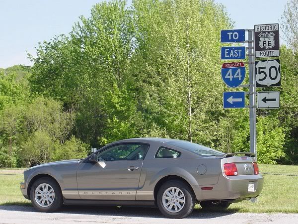
Apparently, 66 ran across the Meramec River at a spot called Times Beach. The nearby town had to be closed down for environmental reasons and has been turned into what seems to be a very nice state park with hiking/biking/equestrian trails and river access. The park entrance is a section of route 66 that crossed the Meramec.
The Pony and I drove through and paid homage to the Mother Road.

Missouri has been a mix of Illinois flats with just a bit of rolling mountain (the Ozarks, I think). The road has been smooth, though, with wide, looping curves over and around the hills, not the tighter 'S' curves of WV and OH. Can't really mention any specific towns I passed through, unfortunately. An hour or so past Route 66 Park, I realized that things were beginning to blur together and it actually surprised me to think that my hike at Starve Hollow two states ago was just yesterday morning. I'm going to have to go back and re-read what I've written every few days to keep myself oriented.
Ended up in Sedalia, MO, about 7:30 pm with 285 miles on the trip odometer, so I checked in to a Comfort Inn and headed out to find Le Maire's (a Cajun-style seafood place mentioned at the Road Trip USA website) for dinner. Fried alligator, red beans, rice, and hush puppies. I'd better damned well find a place to hike tomorrow in Kansas.
Day 4 Wal-Mart count, as of Sedalia= 8, plus 2 distribution centers.
Poor night's sleep in Seymour, IN. A cold room and a hard bed made for insomnia in the middle of the night and a stiff shoulder in the morning. Otherwise, though, I'm ready for the day's drive. Breakfast at Larrison's Diner in the itty-bitty downtown of Seymour, IN, birthplace of John Cougar Mellencamp.
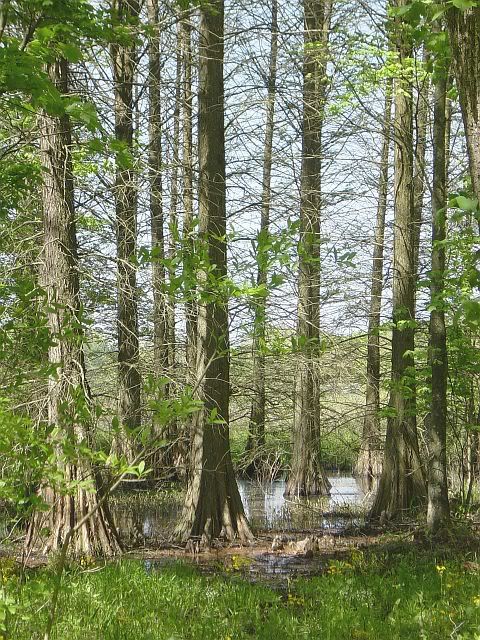
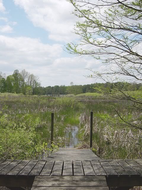
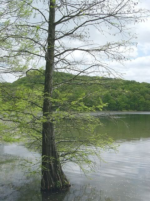
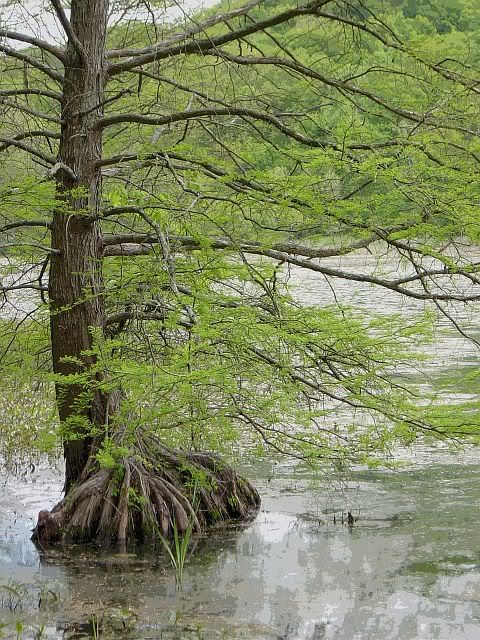
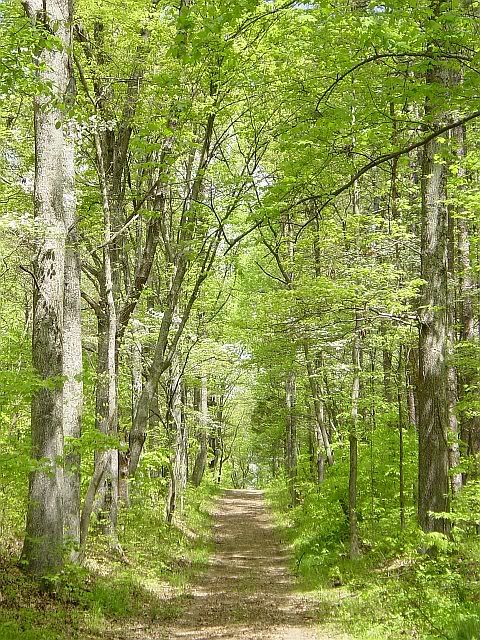
On an impulse, I turned off of 50 at a sign for Starve Hollow State Recreation Area. Serendipity! That impulse more than made up for missing Clifty Falls yesterday. The trail system at Starve Hollow is what the Maryland DNR should strive for. The loop I put together was a mix of old roadbed with real trail: no wider than my two feet together, duff-covered, and discreetly blazed. Very intelligent signage, too, about trail length, difficulty and time necessary to hike. The Vista Trail, in particular, was a gorgeous section, running up and down ravines in a beautiful hardwood forest. Same hardwood mix as the mid-Atlantic region (Tulip Poplar, White and other Oaks, Sweetgum, assorted Maples, American Beech), with the addition of Bald Cypress scattered around the shallows of the lake.


A bittersweet experience, though, wanting to make it a wandering, time-free hike, but knowing that I have 300 miles to go for the day.

Missed photo-op on the way out of a town I passed through: A Route 50 West sign across the street from a Huck's convenience store, with a big sign featuring a winking Huck Finn. Between photos I want to take and things I want to write while rolling too fast to stop (or there being no place to pull over), I've come to the conclusion that I need a camera implanted in my forehead and a recording device in my brain.
Halfway through Day 3, Wal-Mart count= 3 since leaving home, plus a big distribution center in Seymour. I've yet to see any new housing developments or "Land For Sale" signs. It's a relief to find that the rampant development that I see back home does reach a limit along the blue highways.
Another detour off of 50 down to French Lick Springs Resort, IN, which I read about at the Road Trip USA website. The plan had been to see about getting a massage, but I'm just not making good time today. So, lunch and maybe a couple of photos, then back up to 50 and hopefully 200 more miles.
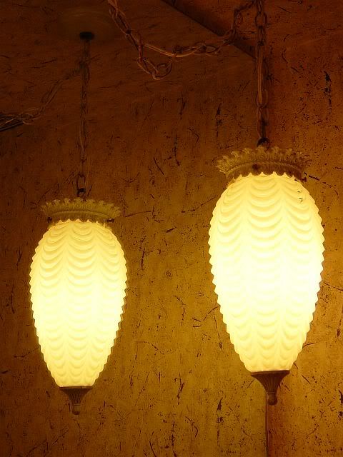
The resort ended up being the type of place with rocking chairs on the big front porch (which overlooked the golf course and a Huck's convenience store across the street) and icerberg lettuce in the $12 steak salad. The things that impressed me most were a statue of Mephistofoles (read Faust) behind the bar and the light fixtures in the ladies room. Faded glory... Must have been quite a grand place back in the day.

From Seymour, through the detour to French Lick, and on through Loogootee, Indiana has been fairly flat stretches interspersed with curves over and down hilly ridges. Fun driving. Passing through some town between Loogootee and Washington, I considered staying the night at an Amish inn, but I just had too many miles to do to give in to that novelty. West of Washington, the land flattened out and the road widened to four lanes, so I pushed the Pony up over 80 and let it run. Almost let it run out of gas, too. Had to make an emergency pull-off to look for a station. I aimed for Palestine (buying gas in Palestine would have been just too appropriate), but Vincennes was closer and I was on the red line. So, I got to visit my first Huck's.
I made no stops from Vincennes, IN, all the way through to Salem, IL. Just past Vincennes, crossed the Wabash River into IL on a bridge named for Red Skelton. I'm not kidding. This was just the start of amusingly named things in IL. Passed on the way to Salem:
- The Embarras River. Yes, only one 's'
- The town of Olney. Normal enough name, but home to albino squirrels.
- The town of Xenia, gotten to via Xenia Iola Rd.
- The towns of Iuka and Omega
- A creek named Skillet Fork
- Dums Creek, which the road crossed three times.
And, last but not least, Effingham, the town that tries to watch its language, but just can't quite.
Observation: The Pony and I have killed more bugs in one afternoon crossing the flatlands of Illinois than in the past two days through VA, WV, OH & IN. The windshield's a mess.
Checked into a jacuzzi room at the Comfort Inn just west of Salem, around 8 pm. 345 miles for the day.
Woke to an overcast day in Parkersburg, WV. It had rained overnight. Got up, ate a granola bar, packed and headed out before 9 am, planning on breakfast in Athens, OH. A short trip across the Ohio River led to clearing skies and a missed exit. Made a quick u-turn that wouldn't have got me a job stunt driving in the movies, but that did get me going in the right direction and back onto 50. Eastern OH looks like Carroll and Frederick counties in MD, with a bit of Allegheny county thrown in. Very pretty. I wonder when I'll get to the point that the area I'm driving through will no longer remind me of anything familiar. Maybe at that point the magnitude of what I'm doing will hit me and I'll actually get excited. So far, it's just like one of my annual trips to western MD-- I'm eager and enjoying everything, but not jump-up-and-down excited.
Breakfast in Athens at Casa Nueva. Just the sort of college-town, hip/hippie place I'm hoping to eat in as much as possible. Had eggs sunny-side up, marinated tofu, home fries, toast and fruit. Excellent.
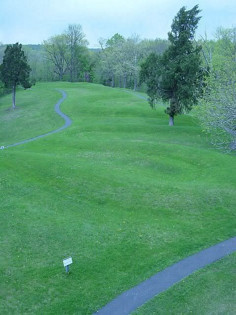
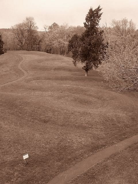
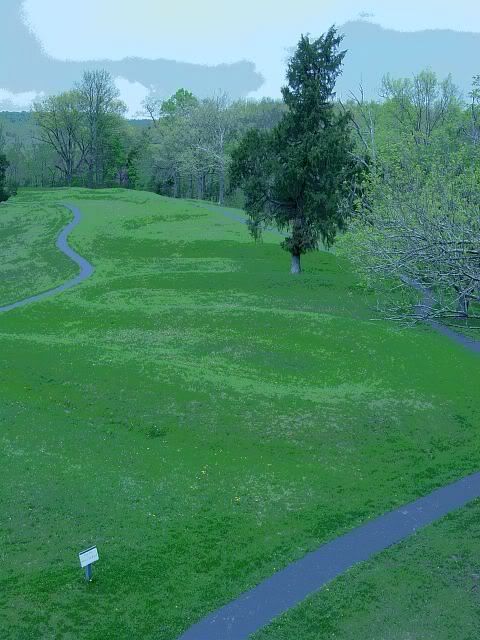
Detoured down route 41 under a variably cloudy sky to check out Serpent Mound. Had a nice-but-short meander along Ohio Bush Creek and took photos of the mound,...


...then back up route 73 to catch up with 50 at Hillsboro, OH. Finally noticed a distinct change in the landscape and geology. The mountains of WV and OH are gone, replaced by scenery more reminiscent of where 50 runs through the eastern shore of MD, only more so.
Very quaint, Arts-and-Crafts-style Mariemont, OH, is the home of Milestone #1: The first Starbuck's I've seen since home.
Passed around and through Cincinatti so fast I that I couldn't get any pics. Thought about going back and cruising the city, but was on a roll. West of Cinci, pastoral views have been replaced by a long industrial stretch with road construction, cutting four lanes down to two and slowing the pace considerably.
The passage into Indiana was uneventful, so much so that I didn't even realize I had changed states until I looked around and realized I was surrounded by IL license plates. After an aborted 25 mile detour to find Clifty Falls State Park (too far, gave up, added 50 miles to the day), stopped at a family-style joint in Versaille for a pork chop dinner. The long distance between highway signs inspired today's worn out phrase: "I sure hope I'm still on 50..."
Approximately 360 miles today (drove extra to make up for Serpent Mound and aborted Clifty Falls detours). I'm tired. But, I'm getting used to the automatic transmission of the Mustang. Actually, after two 5000 rpm passes of slower cars, I'm beginning to really enjoy the Pony. If Ford were to come out with a hybrid model of the 'Stang, I might consider giving up my Honda.
A bit beyond my dinner-stop in Versaille, I drove past the American Dream: Dad, in denim overalls, tossing a baseball with Junior on the front lawn of a ranch-style home.
Checked in to a Holiday Inn in Seymour, IN, just before 8 pm.


I left home approximately 9 am-ish and headed west to Rte 15 South in order to hook up with Rte 50 West down around Middleburg, VA. I've been familiar with Rte 50 through MD and VA for most of my life, so as far as I'm concerned this trip begins when I hit less familiar territory, namely WV. Today's a cool, clear day, with a blue sky and scattered puffy clouds. Started out the trip by getting snagged in a radar trap just before Winchester, VA. 74 in a 55. I had actually been doing 76, but I told the cop that the car was a rental and I wasn't yet used to how it felt. He lowered the charge to 74 mph so it wouldn't be considered reckless (Reckless? Me??) and told me that I was the sixth rented Mustang he'd pulled over that weekend.
I have to note that I'm not sure the manager at Hertz realized what he was doing in giving me a car with only 1397 miles on it. It's going to be well broken in by the time I reach San Francisco.
Romney, WV. My parents have property in Romney that I've only visited once. Shame I haven't gotten out there more, I noticed a handful of reasons to go back: Indian Mound Cemetery, just west of town, looks to have some serious photo opportunities; South Branch River (south branch of the Shenandoah?) looks very paddle-able and I think I've seen mention of it at the Monocacy Canoe Club message board; Civil War history that I've read about and should check out the sites of.
Through VA, WV, the little bottom tip of MD that cuts down into WV, and into WV again, the road has been lined with blooming redbud trees. Once the road hits the Mononghehela area, though, the redbuds give way to hemlocks.
Stopped for a hike through Cathedral State Park. Very pretty, very tiny park of hemlock, rhodedendrons and moss. (Post-trip note: The hemlocks here are like baby cousins to what's to come at the end of the trip.)


Coming down from Cheat Mountain felt very much like driving around Savage Mountain, in Garrett County, MD, but more so. Deeper ravines and higher mountains than around Savage, and I kept wishing there was a spot to pull over and snag a photo. At the bottom, running parallel to the Cheat River, I kept crossing over into the oncoming traffic lane as I craned my neck to check out the river conditions (there were no other cars coming). This is not too far from home to come back and do some kayaking.
Observation: WV apparently does not believe in maintaining a yellow dividing line on curvy mountain roads. Tons of fun (not) when a car's coming towards you.
Today I wore out the phrase, "Ooh, how cool!"

West of Grafton, WV: Stopped on the side of the road to take photos of a cool old house and a portion of Pruntytown State Farm WMA.
The road through the mountains kept causing me to stomp on the brakes to be able to check out the view. From Clarksburg to Parkersburg, 50 widened to four lanes. A smooth 80-85 mph through beautiful mountains reminiscent of Allegheny County, MD, only more so. The town of Bridgeport seemed like Cumberland, MD, crossed with north Baltimore. The views from Grafton through Parkersburg have been so pretty and "Ooh, aah", I have to remind myself that the trip's only just begun.
Checked into a Holiday Inn on the edge of Parkersburg around 8:30 pm.

 Heading west when leaving Ocean City, on the Atlantic Ocean in Maryland, there is a sign that reads "Sacramento, 3200 Miles" (Approximately 3200, I don't remember the exact number). As everyone I know has recently learned, I used to see that sign when I was a kid on the way home from Ocean City summer vacations, and think how cool it would be to get on that road and go all that way, to the very end on the other coast. This year, upon the milestone of turning 40, I decided to do it. The plan was simple: rent a car, buy a plane ticket to get home at the end of the trip, take two weeks off from work for the drive. Everything else was to be pretty much impromptu. For reference along the way, I had three sources: a set of AAA maps, a short Washington Post article from September 21, 2003 describing a similar trip, and the section about Rte 50 from the website Road Trip USA. For inspiration, I had Blue Highways, by William Least Heat-Moon. On the map, 50's a red highway for most of its length, but it's close enough to blue for my purposes.
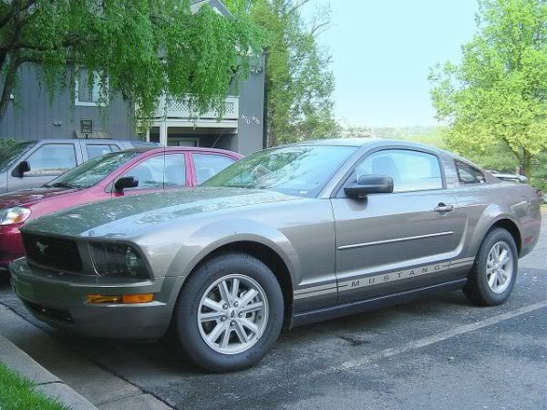
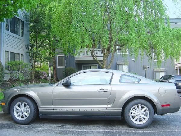
I had planned to document the trip in photos, but hadn't considered a journal until someone I work with suggested it. It wasn't long into the journal notes that I realized there was a sub-plot to the trip: My growing attachment to the car I'd rented -- a 2005 silvery-beige Ford Mustang. An iconic American car for a road-trip through the heart of America. It was perfect.








 Posts
Posts


